
📊 Full opportunity report: The Eye Over The City: How Wide-Area Motion Imagery Works — And Where It Goes Blind on ThorstenMeyerAI.com — validation score, market gap, and execution plan.
TL;DR
Wide-Area Motion Imagery (WAMI) captures entire cityscapes in real-time, enabling detailed tracking and forensic analysis of movement. Its integration with AI enhances surveillance capabilities, but physical and weather-related limits persist.
Wide-Area Motion Imagery (WAMI) technology now allows surveillance systems to monitor entire cities in real-time, capturing and archiving movements of vehicles and pedestrians across several square kilometers. This development significantly enhances urban security and military intelligence, with current applications expanding beyond traditional defense to civilian emergency response and environmental monitoring.
WAMI systems use an array of high-resolution cameras stitched into a single, gigapixel image, enabling analysts to observe and record all activity within a large urban area. For example, DARPA’s ARGUS-IS employs 368 cameras to produce images with enough detail to identify objects as small as six inches from 17,500 feet altitude. This imagery is processed through complex algorithms that stabilize, detect movement, and archive data for later review. Because of the enormous data rates, real-time human monitoring is impractical, making AI and automation essential for effective analysis.The technology originated in early 2000s research at Lawrence Livermore National Laboratory, later evolving into systems deployed on military aircraft, drones, and surveillance platforms. Its primary military use has been network discovery, such as tracing back from an attack to identify the origin of threats, and border security. Civilian applications include wildfire mapping and disaster response, where WAMI provides large-area situational awareness. However, despite its broad utility, WAMI faces notable limitations, including weather dependency and operational costs.
The eye over the city: how Wide-Area Motion Imagery works — and where it goes blind
A normal drone sees through a soda straw. WAMI watches an entire city at once, tracks every mover, and records it all for forensic rewind. Immense reach — with hard limits that make radar and AI its necessary partners.
- City-scale motion, fine detail
- Forensic rewind
- Cloud / smoke / dark degrade it
- Needs a platform loitering overhead
sensing
+ AI
- Sees through cloud & total dark
- Tasked over denied airspace
- Persistent, wide-area from orbit
- Sovereign · on-prem · air-gap
The same archive that traces a bomber to a safe house can trace anyone home — retroactively, without prior suspicion. Baltimore’s secret 2016 deployment led to a 2021 federal ruling that persistent aerial tracking violated the Fourth Amendment. The security value is real; so is the mass-surveillance risk. Who owns the sensor, the archive, and the AI is the accountability question.
WAMI’s power is the archive and the AI reading it; its weakness is weather, airspace, and oversight. The mature posture isn’t optical-vs-radar or capability-vs-liberty — it’s layered sensing (optical WAMI + all-weather SAR), AI-enabled exploitation, and sovereign, auditable control of the whole chain. WAMI shows what a persistent eye can do with clear skies and owned airspace; for the cloud, the night, and the denied area, the radar layer is where the resilient coverage lives.
Impacts of WAMI on Urban Security and Surveillance
WAMI’s ability to record and analyze entire cityscapes in real-time offers a transformative tool for law enforcement, military operations, and emergency responders. Its forensic capabilities enable detailed reconstruction of events, improving incident response and threat detection. However, the technology’s reliance on optical sensors means it is limited by weather conditions and requires significant infrastructure and bandwidth, raising questions about operational costs and governance.
Real HD 2MP Dome TVI AHD CCTV Surveillance Security Camera, 2.8mm 100° Wide Viewing Angle, 1080P Dome Camera, 65ft Night Vision, Outdoor, Compatible with Analog TVI AHD CVI DVR, Full Metal Housing
This camera is 2 Megapixels high definition 1080p HD TVI/AHD/CVI/960H(1000 TVL), 65ft IR night vision range. It has…
As an affiliate, we earn on qualifying purchases.
As an affiliate, we earn on qualifying purchases.
Evolution of Wide-Area Motion Imagery and Its Deployment
WAMI technology traces its roots to early 2000s research at Lawrence Livermore National Laboratory, transitioning to military use with systems like DARPA’s ARGUS-IS and the Gorgon Stare pods on Reaper drones. Over two decades, it has shifted from experimental prototypes to proliferating sensor suites on aircraft, drones, and tethered platforms. Its applications have expanded from battlefield reconnaissance to civilian disaster management and environmental monitoring, reflecting its growing importance in diverse sectors.
“While WAMI is powerful, it’s limited by weather and the need for overhead platforms within reach of the target area.”
— John Marion, former project lead at Lawrence Livermore
gigapixel city monitoring system
As an affiliate, we earn on qualifying purchases.
As an affiliate, we earn on qualifying purchases.
Current Challenges and Limitations of WAMI Systems
Despite advancements, WAMI remains constrained by weather conditions such as clouds, haze, and darkness, which degrade optical sensors. Its reliance on overhead platforms also limits its use in contested or denied airspace. The high operational costs associated with aircraft hours and bandwidth are ongoing concerns, and the integration of AI for automation, while progressing, is still evolving. The full extent of future capabilities and governance issues remains to be clarified as deployment scales up.
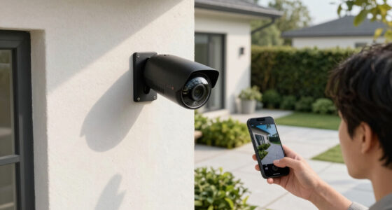
AI-enabled urban surveillance camera
As an affiliate, we earn on qualifying purchases.
As an affiliate, we earn on qualifying purchases.
Future Developments and Integration with Other Modalities
Future efforts will likely focus on enhancing AI-driven automation for real-time analysis, expanding sensor fusion with radar systems like SAR to overcome weather limitations, and reducing operational costs. The development of smaller, more versatile platforms is expected to broaden WAMI deployment in tactical environments. Regulatory and governance frameworks will also evolve to address privacy and oversight concerns as the technology becomes more widespread.
drone-based wide-area motion imagery system
As an affiliate, we earn on qualifying purchases.
As an affiliate, we earn on qualifying purchases.
Key Questions
How does WAMI differ from traditional surveillance cameras?
WAMI captures a large geographic area in a single, high-resolution image, allowing for comprehensive tracking of movement across an entire city, unlike traditional cameras which focus on narrow fields of view.
What are the main limitations of WAMI technology?
WAMI is limited by weather conditions such as clouds and darkness, requires overhead platforms within reach of targets, and involves high operational costs related to aircraft hours and data bandwidth.
How is AI used in WAMI systems?
AI automates the detection, tracking, and archiving of moving objects within the gigapixel images, enabling analysts to quickly review events and conduct forensic investigations without real-time human monitoring.
Can WAMI be used in urban environments with dense buildings?
WAMI’s optical sensors can be limited by urban canyons and obstructions, but their deployment on elevated platforms can mitigate some of these issues; nonetheless, dense environments pose challenges for continuous coverage.
What is the future of WAMI in civilian applications?
As sensor technology and AI improve, WAMI is expected to expand into areas like disaster response, urban planning, and environmental monitoring, providing large-scale, detailed situational awareness.
Source: ThorstenMeyerAI.com