
📊 Full opportunity report: The City That Watches Itself: The Living Digital Twin, And The God’s-Eye View We’re Building on ThorstenMeyerAI.com — validation score, market gap, and execution plan.

Get business pricing on office and shipping supplies
- Business-only prices and quantity discounts
- Tax-exempt purchasing
- Multiple users, one account, clear invoices
TL;DR
Cities are evolving into living digital twins, combining real-time data, advanced sensors, and AI to monitor and simulate urban environments. This development enhances planning but raises surveillance concerns. The process is ongoing, with key implementations like Singapore’s Virtual Singapore leading the way.
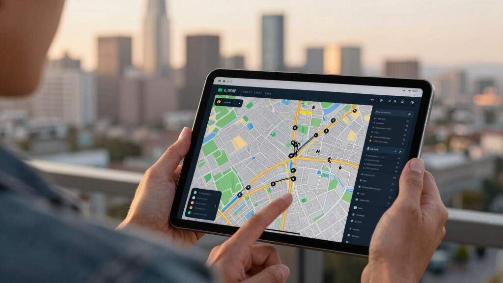
Cities are increasingly adopting dynamic digital twins that integrate real-time data from multiple sensors, AI, and satellite imagery to create live, interactive models of urban environments. This technological shift allows cities to monitor their infrastructure, traffic, and environment continuously, enabling predictive planning and management. The development is driven by advances in sensor technology, AI comprehension, and data integration, making these models more sophisticated and responsive than ever before. This evolution matters because it transforms urban governance from reactive to anticipatory, but also introduces significant surveillance concerns.
One prominent example is Singapore’s Virtual Singapore, a comprehensive 3D digital twin modeling every building, road, and utility with live overlays. Cities like Helsinki and Las Vegas are also operating similar models that have demonstrated cost savings and improved urban planning accuracy. The key technological breakthrough is the integration of Wide-Area Motion Imagery (WAMI), which allows continuous, rewindable tracking of vehicles and pedestrians across the city, creating a detailed record of urban movement.
Adding synthetic-aperture radar (VigilSAR) enables these models to see through clouds, darkness, and smoke, ensuring 24/7 coverage. The final piece is frontier AI, capable of understanding complex data patterns and enabling natural language queries, transforming these models into interactive, oracle-like tools. This combination turns the digital twin from a static map into a living, breathing replica of the city that can be queried and simulated in real time.
The city that watches itself: the living digital twin, and the god’s-eye view we’re building
Soon most cities will exist twice — once in concrete, once as a live data model you can rewind, simulate, and question in plain language. Persistent sensing + frontier AI turn the planner’s digital twin into an oracle. The most useful thing we’ve built — and the most powerful surveillance instrument. Both at once.
- Plan better — cities & rural: traffic, zoning, energy, land use
- Emergency response — route crews, one live picture, ~50% faster
- Disaster resilience — simulate, track live, assess damage in hours
- Mass surveillance — track everyone, retroactively, forever
- Pattern-of-life — AI links movements, infers associations
- Social control — no warrant, no suspicion (cf. Baltimore, 2021 ruling)
We’re building a city that watches itself, remembers everything, and can be asked anything. The technology won’t choose between saving lives and ending privacy — we will, through the rules we write now, while the twin is still under construction and the defaults haven’t yet hardened into permanence. WAMI and the living twin open our lives to a view from the heavens that, from the dawn of civilization until a heartbeat ago, was reserved for gods and stars. The question is no longer whether we can see everything — it’s who gets to look, and who watches the watchers.
Implications of Self-Monitoring Urban Environments
This technological evolution has profound implications. It enhances urban planning, allowing authorities to simulate and optimize infrastructure projects before implementation, reducing costs and errors. It also supports environmental monitoring, disaster response, and resource management on a scale previously impossible. However, the same capabilities pose significant surveillance risks, as these models can track individual movements, behaviors, and infrastructure vulnerabilities in detail. The potential for misuse or overreach raises questions about privacy, sovereignty, and control over critical data.
As an affiliate, we earn on qualifying purchases.
Progress and Challenges in Digital Twin Technologies
The concept of digital twins originated in manufacturing and aerospace, but recent technological advances have made their application in cities feasible. Singapore launched Virtual Singapore after severe flooding in 2012, aiming to improve urban resilience and planning. Other cities have followed, leveraging sensor networks, satellite data, and AI to create more comprehensive models. The key challenge remains understanding and controlling the vast data streams generated, especially as frontier AI models become capable of interpreting and querying this data in natural language, turning a city into an interactive, self-aware entity.
While the technology is progressing rapidly, concerns about data sovereignty, security, and ethical use are mounting. The potential for foreign-controlled models or data to influence city management underscores the need for clear governance frameworks.
“Cities are becoming living data models that can be queried, simulated, and even predicted with unprecedented accuracy.”
— Thorsten Meyer, AI researcher
As an affiliate, we earn on qualifying purchases.
Unresolved Issues and Risks of Self-Monitoring Cities
While the technological capabilities are advancing rapidly, several uncertainties remain. It is not yet clear how widespread adoption will be, especially in terms of governance and privacy protections. The security of these interconnected systems against hacking or misuse is still a concern. Additionally, the extent to which frontier AI models can reliably interpret complex urban data without bias or error remains to be fully tested in real-world scenarios. The potential for foreign control or influence over critical city infrastructure through these models is also an unresolved issue.
As an affiliate, we earn on qualifying purchases.
Next Steps in Developing and Regulating Digital Twins
Moving forward, cities are expected to expand their digital twin capabilities, integrating more sensors and AI functionalities. Governments and regulators are likely to develop frameworks to address privacy, security, and sovereignty concerns. International cooperation may become necessary to establish standards and prevent misuse. Technologically, improvements in AI comprehension and sensor deployment will continue, making these models more detailed and interactive. The ongoing development will test the balance between urban innovation and civil liberties.
AI-powered city surveillance cameras
As an affiliate, we earn on qualifying purchases.
As an affiliate, we earn on qualifying purchases.
Key Questions
What is a digital twin in a city?
A digital twin is a dynamic, three-dimensional virtual replica of a city that integrates real-time data from sensors, satellite imagery, and other sources to monitor, simulate, and analyze urban environments.
How does WAMI technology enhance city monitoring?
WAMI provides continuous, wide-area surveillance of vehicles and pedestrians, allowing cities to track movement patterns, rewind footage, and create detailed records of urban activity.
What are the privacy concerns associated with digital twins?
Because these models can track individual movements and behaviors in detail, there are significant concerns about privacy, data security, and potential misuse by governments or third parties.
Are digital twins already being used in cities today?
Yes, cities like Singapore, Helsinki, and Las Vegas are operating digital twins for planning, management, and operational purposes, with ongoing development toward more comprehensive and interactive models.
What are the risks of foreign control over city digital twins?
If a city relies on foreign-developed AI models or cloud services, critical infrastructure data could be influenced or accessed remotely, raising sovereignty and security issues.
Source: ThorstenMeyerAI.com
Halloween Picks
halloween
As an affiliate, we earn on qualifying purchases.